
File:A71 map fr.png

Size of this preview: 453 × 599 pixels. Other resolutions: 181 × 240 pixels | 363 × 480 pixels | 1,010 × 1,335 pixels.
Original file (1,010 × 1,335 pixels, file size: 202 KB, MIME type: image/png)
| Description |
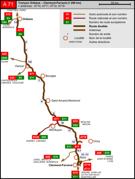
English: Map of the A71 autoroute in France. Made with OpenOffice.org Draw and Inkscape.
Français : Carte de l'autoroute A71 en France. Réalisé avec OpenOffice.org Draw et Inkscape. |
| Date | |
| Source | Own work |
| Author | Tabl-trai |
| Permission (Reusing this file) |
This file is licensed under the Creative Commons Attribution-Share Alike 2.0 France license.
 |
File history
Click on a date/time to view the file as it appeared at that time.
| Date/Time | Thumbnail | Dimensions | User | Comment | |
|---|---|---|---|---|---|
| current | 12:58, 4 April 2009 | | 1,010 × 1,335 (202 KB) | Tabl-trai | {{Information |Description={{en|1=Map of the A71 autoroute in France. Made with OpenOffice.org Draw and Inkscape.}} {{fr|1=Carte de l'autoroute A71 en France. Réalisé avec OpenOffice.org Draw et Inkscape.}} |Source=Own work by uploader |Author=[[User:Ta |
File usage
There are no pages that use this file.
Global file usage
The following other wikis use this file:
- Usage on fr.wikipedia.org