
File:Hawaii topo 1971.jpg

Size of this preview: 690 × 599 pixels. Other resolutions: 276 × 240 pixels | 553 × 480 pixels | 884 × 768 pixels | 1,179 × 1,024 pixels | 2,357 × 2,048 pixels | 5,000 × 4,344 pixels.
Original file (5,000 × 4,344 pixels, file size: 3.48 MB, MIME type: image/jpeg)
Summary
| Description |
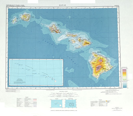
English: topographic map of Hawaii islands, scale 1:1 million, 1971 |
| Date | |
| Source | U.S. Geological Service (scanned by uploader) |
| Author | U.S. Geological Service |
Licensing
This image is in the public domain in the United States because it only contains materials that originally came from the United States Geological Survey, an agency of the United States Department of the Interior. For more information, see the official USGS copyright policy.
|
File history
Click on a date/time to view the file as it appeared at that time.
| Date/Time | Thumbnail | Dimensions | User | Comment | |
|---|---|---|---|---|---|
| current | 22:05, 31 July 2010 | | 5,000 × 4,344 (3.48 MB) | Allesmüller~commonswiki | {{Information |Description={{en|1=topographic map of Hawaii islands, scale 1:1 million, 1971}} |Source=U.S. Geological Service (scanned by uploader) |Author=U.S. Geological Service |Date=1971 |Permission= |other_versions= }} Category:Maps of Hawaii |
File usage
The following page uses this file:
Global file usage
The following other wikis use this file:
- Usage on als.wikipedia.org
- Usage on de.wikipedia.org
- Usage on es.wikipedia.org
- Allerton Garden
- Kahanu Garden
- Jardín botánico del Cráter Koko
- Jardín botánico Foster
- Jardín botánico Liliʻuokalani
- Jardín botánico Ho'omaluhia
- Jardín botánico Wahiawa
- World Botanical Gardens
- Valle Waimea
- Encantadores jardines florales de Kula
- Jardín de hierbas medicinales de Hi'iaka
- Jardines tropicales de Hilo
- Jardín botánico de Kula
- Jardín botánico de Maui Nui
- Limahuli Garden and Preserve
- McBryde Garden
- Merwin Conservancy
- Jardín botánico Na 'Aina Kai
- Plantación y jardín botánico Olu Pua
- Arboreto y jardín botánico de Pua Mau Place
- Jardín botánico de Sadie Seymour
- Área recreativa y bosque estatal de autóctonas Kalopa
- Parque estatal Manuka Wayside
- Jardines botánicos tropicales del rancho Kaia
- Arboreto Lyon
- Jardines botánicos de la universidad de Hawái campus de Hilo
- Jardines Moir
- Ke'anae Arboretum
- Usage on ru.wikipedia.org