
File:Barents Sea map hr.svg

Size of this PNG preview of this SVG file: 512 × 466 pixels. Other resolutions: 264 × 240 pixels | 527 × 480 pixels | 844 × 768 pixels | 1,125 × 1,024 pixels | 2,250 × 2,048 pixels.
Original file (SVG file, nominally 512 × 466 pixels, file size: 375 KB)
Summary
| Description |
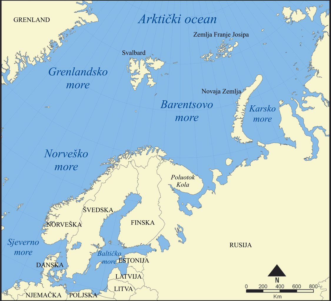
Hrvatski: Barentsovo more |
||
| Date | |||
| Source | Own work based on: Barents Sea map.png | ||
| Author |
Vector: |
||
| Other versions |
[]
|
||
| SVG development |
|


Licensing
I, the copyright holder of this work, hereby publish it under the following licenses:
This file is licensed under the Creative Commons Attribution-Share Alike 3.0 Unported license.
- You are free:
- to share – to copy, distribute and transmit the work
- to remix – to adapt the work
- Under the following conditions:
- attribution – You must give appropriate credit, provide a link to the license, and indicate if changes were made. You may do so in any reasonable manner, but not in any way that suggests the licensor endorses you or your use.
- share alike – If you remix, transform, or build upon the material, you must distribute your contributions under the same or compatible license as the original.

|
Permission is granted to copy, distribute and/or modify this document under the terms of the GNU Free Documentation License, Version 1.2 or any later version published by the Free Software Foundation; with no Invariant Sections, no Front-Cover Texts, and no Back-Cover Texts. A copy of the license is included in the section entitled GNU Free Documentation License. |
You may select the license of your choice.
File history
Click on a date/time to view the file as it appeared at that time.
| Date/Time | Thumbnail | Dimensions | User | Comment | |
|---|---|---|---|---|---|
| current | 19:58, 5 May 2018 | | 512 × 466 (375 KB) | JoKalliauer | try to solve https://phabricator.wikimedia.org/T193929 |
| 11:58, 5 May 2018 |  | 1,006 × 921 (375 KB) | JoKalliauer | made file valid, but could not solve the librsvgbug | |
| 17:09, 13 February 2012 |  | 1,006 × 921 (488 KB) | MaGa | Reverted to version as of 12:31, 13 February 2012 | |
| 17:08, 13 February 2012 |  | 1,006 × 921 (479 KB) | MaGa | Let's try again... | |
| 12:31, 13 February 2012 |  | 1,006 × 921 (488 KB) | MaGa | Display error correction | |
| 12:25, 13 February 2012 |  | 1,006 × 921 (488 KB) | MaGa | Kola Peninsula added | |
| 12:20, 13 February 2012 |  | 1,006 × 921 (475 KB) | MaGa | {{Information |Description={{hr|Barentsovo more}} |Source=*File:Barents Sea map.png |Date=13. veljače 2012. |Author=*Norwegian Sea map.png: NormanEinstein *[[User:MaGa|<font color="Grey">'''Ma''' |
File usage
There are no pages that use this file.
Global file usage
The following other wikis use this file:
- Usage on hr.wikipedia.org
- Usage on sh.wikipedia.org
- Usage on sr.wikipedia.org