
File:Flags – Wikidata-tagged flags on flagpoles in OpenStreetMap as of 30 June 2020.pdf

Size of this JPG preview of this PDF file: 424 × 600 pixels. Other resolutions: 170 × 240 pixels | 339 × 480 pixels | 543 × 768 pixels | 724 × 1,024 pixels | 1,448 × 2,048 pixels | 4,964 × 7,020 pixels.
Original file (4,964 × 7,020 pixels, file size: 2.23 MB, MIME type: application/pdf)
Summary
| Description |
English: A poster submission to the State of the Map 2020 conference, titled “Flags”, that depicts over 3,000 nodes in OpenStreetMap with flag:wikidata tags, each one identifying the specific flag design or designs that fly on an outdoor flagpole. The poster includes a world map of the flagpoles and a bar chart of the most commonly mapped flags. Multiple flags on a flagpole are counted individually. Each bar in the bar chart is color-coded by the type of entity represented by the flag and resembles a flagpole with the flag at the top. |
| Date | |
| Source | Own work |
| Author | Minh Nguyen |
| Other versions |
This file was derived from: Flags – Wikidata-tagged flags on flagpoles in OpenStreetMap as of 30 June 2020.svg |
Licensing
I, the copyright holder of this work, hereby publish it under the following license:
| This file is made available under the Creative Commons CC0 1.0 Universal Public Domain Dedication. | |
| The person who associated a work with this deed has dedicated the work to the public domain by waiving all of their rights to the work worldwide under copyright law, including all related and neighboring rights, to the extent allowed by law. You can copy, modify, distribute and perform the work, even for commercial purposes, all without asking permission.
|
File history
Click on a date/time to view the file as it appeared at that time.
| Date/Time | Thumbnail | Dimensions | User | Comment | |
|---|---|---|---|---|---|
| current | 17:31, 2 July 2020 | 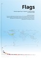 | 4,964 × 7,020 (2.23 MB) | Mxn | Uploaded own work with UploadWizard |
File usage
There are no pages that use this file.