
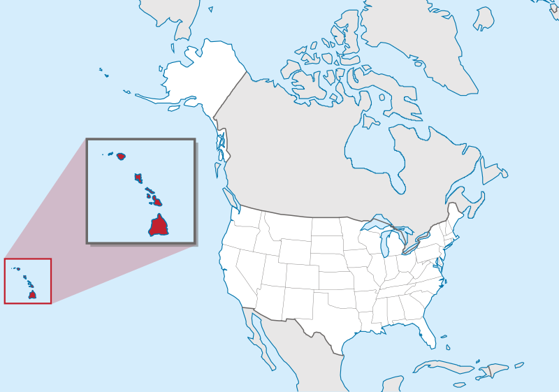
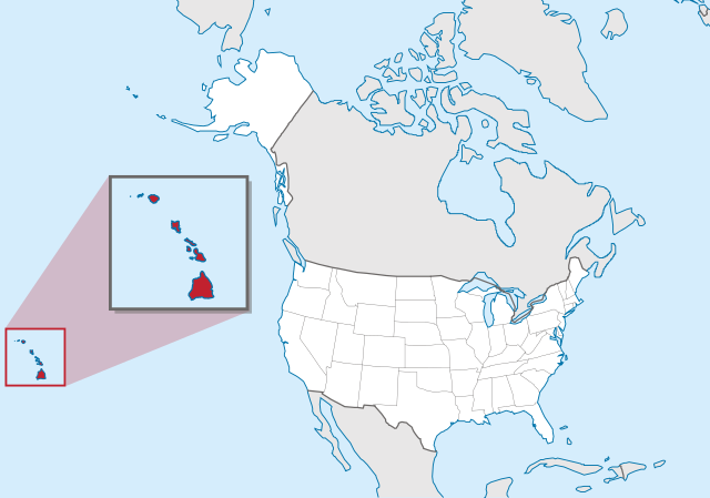
File:Hawaii in United States (zoom) (US50) (-grid).svg

Size of this PNG preview of this SVG file: 800 × 561 pixels. Other resolutions: 320 × 224 pixels | 640 × 449 pixels | 1,024 × 718 pixels | 1,280 × 897 pixels | 2,560 × 1,795 pixels | 2,078 × 1,457 pixels.
Original file (SVG file, nominally 2,078 × 1,457 pixels, file size: 256 KB)
Summary
.svg)
.svg)
.svg)
.svg)
.svg)
.svg)
.svg)

-en.svg)

.svg)
.svg)
.svg)

_(US48).svg)
_(small_islands_magnified)_(-mini_map_-rivers).svg)
.svg)
_(extra_close)_(US48).svg)
.svg)
_(zoom).svg)

.svg)


_(UNMIK).svg)
.svg)
_(disputed_hatched).svg)
_(claimed_and_disputed_hatched).svg)
.svg)
.svg)
_(%2Ball_claims_hatched).svg)

.svg)
_(shade).svg)
_(shade)_(special_marker).svg)
_(-mini_map).svg)
_(-mini_map).svg)
_(-mini_map).svg)


.svg)

.svg)
_(US50)_(-grid).svg)
Licensing
This image is in the public domain in the United States because it only contains materials that originally came from the United States Geological Survey, an agency of the United States Department of the Interior. For more information, see the official USGS copyright policy.
|

|
I'd greatly appreciate, that you attribute this media file to Wikimedia Commons, if used outside Wikipedia or Commons. For use in publications such as books, newspapers, blogs, websites, please insert here the following line:
|
_(US50)_(-grid).svg&action=edit&redlink=1)
File history
Click on a date/time to view the file as it appeared at that time.
| Date/Time | Thumbnail | Dimensions | User | Comment | |
|---|---|---|---|---|---|
| current | 18:11, 20 March 2012 | | 2,078 × 1,457 (256 KB) | TUBS | corr alabama colors |
| 21:00, 30 July 2011 |  | 2,078 × 1,457 (395 KB) | TUBS | == {{int:filedesc}} == {{Information |Description={{de|Lage von XY (siehe Dateiname) in den Vereinigten Staaten.}} {{en|Location of state of XY (see filename) in the United States}} |Source={{own}}{{Adobe |
File usage
The following page uses this file:
Global file usage
The following other wikis use this file:
- Usage on az.wiktionary.org
- Usage on bg.wikipedia.org
- Usage on bh.wikipedia.org
- Usage on bs.wikipedia.org
- Usage on bxr.wikipedia.org
- Usage on ca.wikipedia.org
- Usage on cdo.wikipedia.org
- Usage on ceb.wikipedia.org
- Usage on ce.wikipedia.org
- Usage on chr.wikipedia.org
- Usage on cs.wikipedia.org
- Usage on da.wikipedia.org
- Usage on de.wikipedia.org
- Usage on eml.wikipedia.org
- Usage on en.wikipedia.org
- List of people from Hawaii
- List of Hawaii state symbols
- List of active separatist movements in Oceania
- Wikipedia talk:Graphics Lab/Illustration workshop/Archive 3
- Callistosporium vinosobrunneum
- Marasmiellus hapuuarum
- Marasmius koae
- Mycena marasmielloides
- Pleurocybella ohiae
- Environmental issues in Hawaii
- Paleontology in Hawaii
- Wikipedia talk:WikiProject Maps/Archive 2013
- Wikipedia talk:Graphics Lab/Archive 4
- Wikipedia:Graphics Lab/Map workshop/Archive/Dec 2015
- File talk:Hawaii in United States (zoom) (US50) (-grid).svg
- Usage on en.wikinews.org
- Usage on en.wiktionary.org
- Usage on eo.wikipedia.org
- Usage on fa.wikipedia.org
- Usage on fi.wikipedia.org
- Usage on fi.wikiquote.org
- Usage on fr.wikipedia.org
_(US50)_(-grid).svg)
View more global usage of this file.
_(US50)_(-grid).svg)
_(US50)_(-grid).svg)