
File:Kępa Wieloryb - mapa.png
No higher resolution available.
Kępa_Wieloryb_-_mapa.png (420 × 160 pixels, file size: 30 KB, MIME type: image/png)
| Open this image as an overlay in Google Earth (Google Maps, Bing) | (Help|Source) |
Summary
| Description |
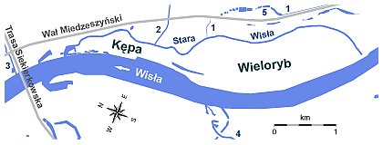
Polski: Kępa Wieloryb w Wawrze (Warszawa) - schematyczna mapka. Oznaczenia: 1 - Rów Miedzeszyński |
| Date | |
| Source |
Own work |
| Author | Darekk2 |
Licensing
I, the copyright holder of this work, hereby publish it under the following license:
This file is licensed under the Creative Commons Attribution-Share Alike 4.0 International license.
- You are free:
- to share – to copy, distribute and transmit the work
- to remix – to adapt the work
- Under the following conditions:
- attribution – You must give appropriate credit, provide a link to the license, and indicate if changes were made. You may do so in any reasonable manner, but not in any way that suggests the licensor endorses you or your use.
- share alike – If you remix, transform, or build upon the material, you must distribute your contributions under the same or compatible license as the original.
File history
Click on a date/time to view the file as it appeared at that time.
| Date/Time | Thumbnail | Dimensions | User | Comment | |
|---|---|---|---|---|---|
| current | 19:27, 17 January 2015 | 420 × 160 (30 KB) | Darekk2 | modyfikacja przebiegu Starej Wisły | |
| 11:40, 17 January 2015 | 420 × 160 (30 KB) | Darekk2 | znowu zgubiło się. | ||
| 11:37, 17 January 2015 | 420 × 160 (29 KB) | Darekk2 | zgubiło się jedno oznaczenie | ||
| 11:25, 17 January 2015 | 420 × 160 (29 KB) | Darekk2 | skas. okresowego dopływu | ||
| 01:44, 17 January 2015 | 420 × 160 (30 KB) | Darekk2 | więcej oznaczeń | ||
| 01:29, 17 January 2015 | 420 × 160 (30 KB) | Darekk2 | Dadanie oznaczeń mniejszych cieków wodnych, zmiana niektórych kolorów. | ||
| 01:12, 17 January 2015 | 420 × 160 (29 KB) | Darekk2 | dodanie strzałki wskazujacej kierunek nurtu Wisły, zmniejszenie grubości dopływu Starej Wisły | ||
| 00:40, 17 January 2015 | 420 × 160 (29 KB) | Darekk2 | dodanie marginesu | ||
| 00:38, 17 January 2015 | 410 × 149 (29 KB) | Darekk2 | User created page with UploadWizard |
File usage
There are no pages that use this file.
Global file usage
The following other wikis use this file:
- Usage on pl.wikipedia.org