
File:Moldova - Descriptio Moldaviae.png

Original file (2,460 × 2,490 pixels, file size: 904 KB, MIME type: image/png)
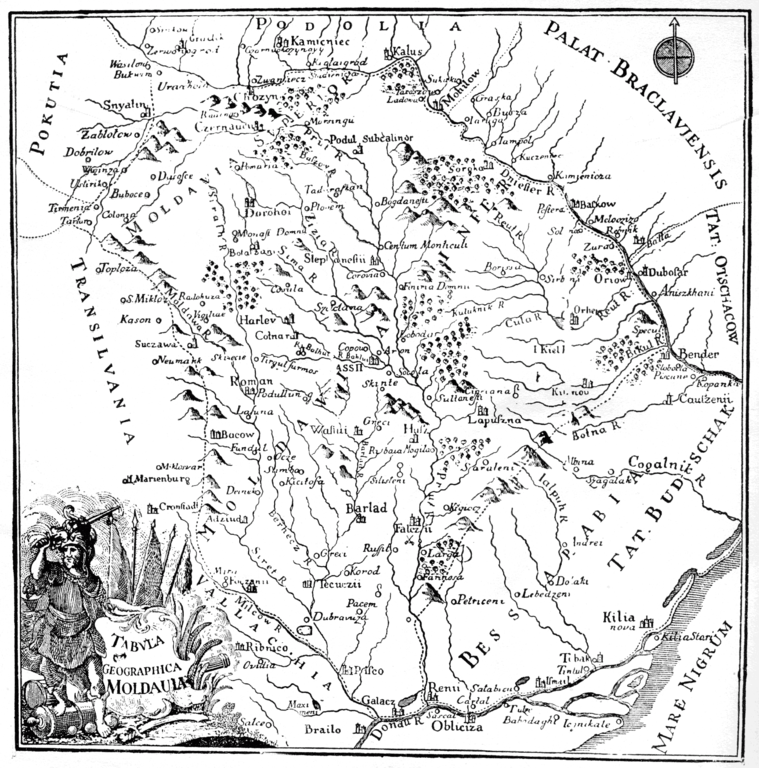
| Description | Moldova in the 1700s. Map created by an anonymous cartographer after the original map of Dimitrie Cantemir (early 1700s) and the map of August Gotlob Boehm (Nurnberg, 1765). It appeared in the first German edition of Descriptio Moldaviae (editor: Büsching, 1769-1770). | ||||
| Date | between circa 1765 and circa 1769 | ||||
| Source | Dimitrie Cantemir, Descriptio Moldaviae, Bucureşti, 1956 | ||||
| Author | anonimous | ||||
| Permission (Reusing this file) |
|
||||
| Other versions | File:Moldova - Descriptio Moldaviae.jpg | ||||
File history
Click on a date/time to view the file as it appeared at that time.
| Date/Time | Thumbnail | Dimensions | User | Comment | |
|---|---|---|---|---|---|
| current | 15:26, 12 December 2007 | | 2,460 × 2,490 (904 KB) | Alex:D | {{Information |Description=Moldova in 1716 |Source=Dimitrie Cantemir, ''Descriptio Moldaviae'', Bucureşti, 1956 |Date=1716 |Author=Dimitrie Cantemir |Permission={{PD-Old}} |other_versions= }} Category:Old_maps_of_Europe Category:Maps of Romania [ |
File usage
The following page uses this file:
Global file usage
The following other wikis use this file:
- Usage on en.wikipedia.org
- Usage on es.wikipedia.org
- Usage on pl.wikipedia.org
- Usage on ro.wikisource.org