
File:Vue du Moulin Marcoux et de la rivière Jacques-Cartier - Pont-Rouge.JPG
Size of this preview: 800 × 450 pixels. Other resolutions: 320 × 180 pixels | 640 × 360 pixels | 1,024 × 575 pixels | 1,280 × 719 pixels | 2,560 × 1,439 pixels | 4,000 × 2,248 pixels.
Original file (4,000 × 2,248 pixels, file size: 3.03 MB, MIME type: image/jpeg)
| Cette photo s'est mérité la 1e position du concours Wikipédia prend Québec This image was imported on Commons as part of the event Wikipédia prend Québec (Wikipedia Takes Quebec city) by participant number 030, Sylvainbrousseau. All images from this participant are under a free license and are categorized in Wikipédia prend Québec - Participant 030. |  |
Summary
| Description |
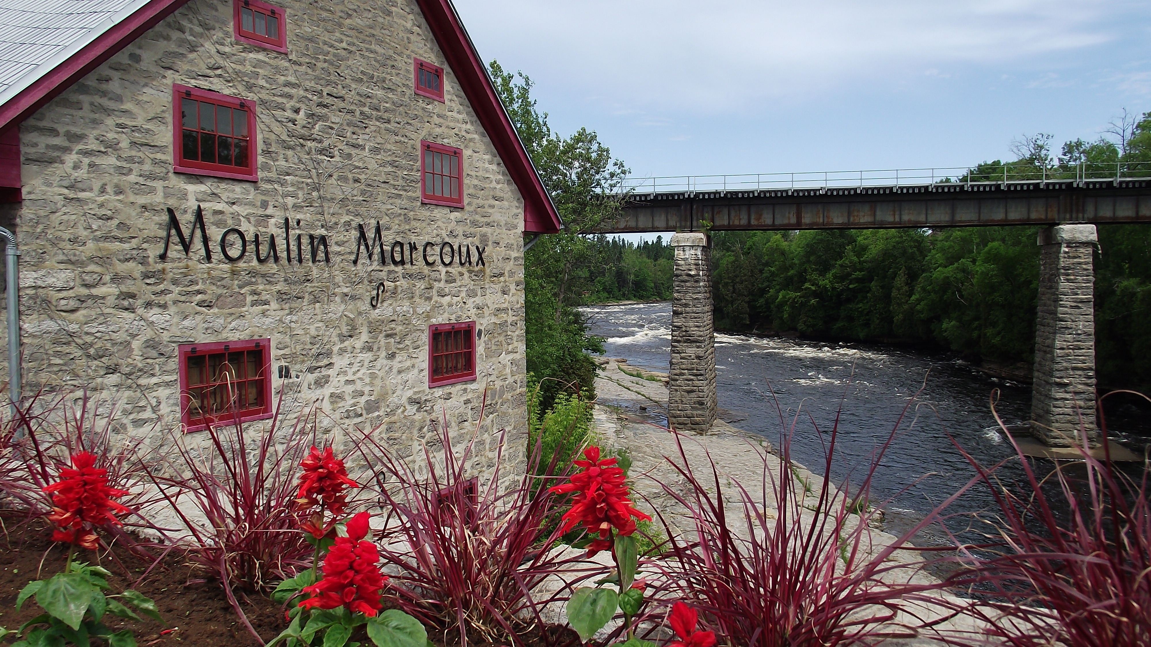
Français : Le Moulin Marcoux est un ancien moulin à farine qui utilisait la puissance de la rivière Jacques-Cartier pour moudre le grain. Il fut par la suite abandonné et menacé de destruction jusqu'à ce que des citoyens décident d'en faire la restauration. Une salle de spectacle et une galerie d'art remplacent maintenant la machinerie. English: Le Moulin Marcoux is an ancient mill which used hydropower from the Jacques-Cartier River to produce flour. Eventually, it was abandoned and under the threat of destruction, until citizens decided to restore it. Rooms which formerly contained the equipment currently host a theater hall and an art gallery. |
| Date | |
| Source | Own work |
| Author | Sylvainbrousseau |
This photo is of a cultural heritage site in Canada, number 4453
|
| Camera location | | View this and other nearby images on: OpenStreetMap |
|---|
Licensing
Sylvainbrousseau, the copyright holder of this work, hereby publishes it under the following license:
This file is licensed under the Creative Commons Attribution-Share Alike 3.0 Unported license.
Attribution: Sylvainbrousseau
- You are free:
- to share – to copy, distribute and transmit the work
- to remix – to adapt the work
- Under the following conditions:
- attribution – You must give appropriate credit, provide a link to the license, and indicate if changes were made. You may do so in any reasonable manner, but not in any way that suggests the licensor endorses you or your use.
- share alike – If you remix, transform, or build upon the material, you must distribute your contributions under the same or compatible license as the original.
File history
Click on a date/time to view the file as it appeared at that time.
| Date/Time | Thumbnail | Dimensions | User | Comment | |
|---|---|---|---|---|---|
| current | 20:37, 16 June 2012 | | 4,000 × 2,248 (3.03 MB) | Sylvainbrousseau |
File usage
The following 3 pages use this file:
Global file usage
The following other wikis use this file:
- Usage on ca.wikimedia.org
- Usage on en.wikipedia.org
- Usage on es.wikipedia.org
- Usage on et.wikipedia.org
- Usage on fr.wikipedia.org