
File:Wale Street, Bo-Kaap (01).jpg
Original file (5,184 × 3,456 pixels, file size: 10.2 MB, MIME type: image/jpeg)
Summary
| Description |
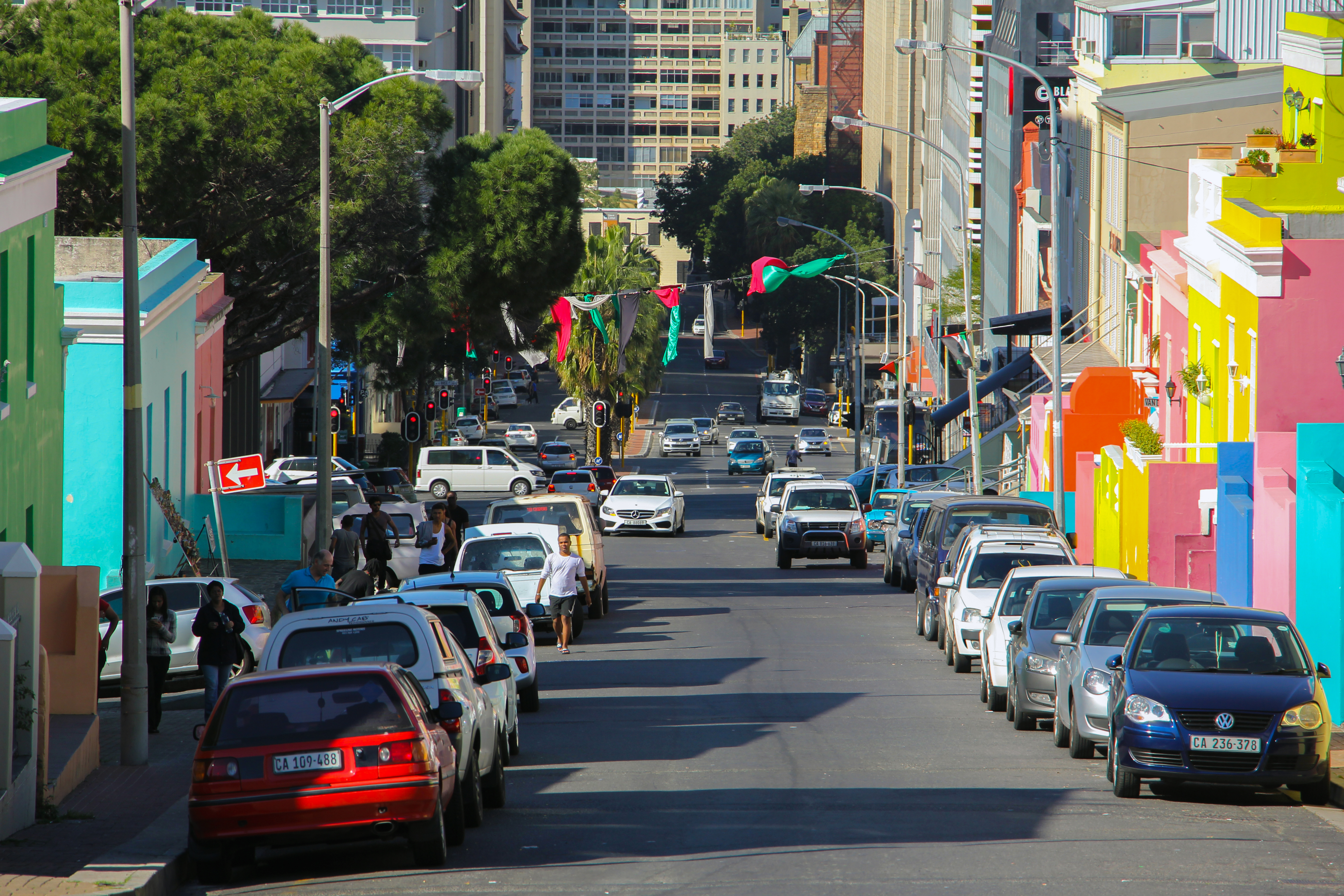
বাংলা: ওয়াল স্ট্রিট, বো-ক্যাপ, কেপ টাউন, দক্ষিণ আফ্রিকা
English: Wale Street, Cape Town (NE-SW axis), Bo-Kaap (fka Malay Quarter), Cape Town, South Africa. A former township situated on the slopes of Signal Hill above the city centre and a historical centre of Cape Malay culture in Cape Town. |
|||||||||||||||||||||||
| Date | Taken on 22 July 2018, 12:12:39 | |||||||||||||||||||||||
| Source | Own work | |||||||||||||||||||||||
| Author |
|
|||||||||||||||||||||||
| Permission (Reusing this file) |
.jpg) License: CC BY-SA 4.0 via Wikimedia Commons This work was published by Moheen Reeyad, and released under the free license CC BY-SA 4.0 which also allows the usage outside of Wikimedia under the following conditions:
Please send me a specimen copy or the URL of the website where the image is used. As a courtesy, however, please let me know about any usage of this photo in any printed medium. Thanks in advance. The Online Attribution Generator offers a good tool to generate an attribution sufficient for your use case. Feel free to contact me via eMail moheenreeyad@wikimedia.org.bd or visit website moheenreeyad.xyz for any questions or in case if you need:
NOTE: Only the terms and conditions mentioned above authorize the free use of this image. Any infringement causes a copyright violation, that may result in a penalty fee of five times the fee suggested by the MFM, inter alia. Templete credit: Martin Kraft, published under the license CC BY-SA 3.0. soucre template)
|
|||||||||||||||||||||||
| Other versions |
|
|||||||||||||||||||||||
| Attribution (required by the license) | © Moheen Reeyad / Wikimedia Commons / / | |||||||||||||||||||||||
.jpg)
.jpg)
.jpg)
.jpg)

.jpg)
.jpg)
| Camera location | | View this and other nearby images on: OpenStreetMap |
|---|
.jpg¶ms=-33.920485_N_0018.413937_E_globe:Earth_type:camera__&language=en)
Licensing
- You are free:
- to share – to copy, distribute and transmit the work
- to remix – to adapt the work
- Under the following conditions:
- attribution – You must give appropriate credit, provide a link to the license, and indicate if changes were made. You may do so in any reasonable manner, but not in any way that suggests the licensor endorses you or your use.
- share alike – If you remix, transform, or build upon the material, you must distribute your contributions under the same or compatible license as the original.
The making of this file was supported by Chattogram WikiCommunity.
For all the files concerned, please see the category Supported by Chattogram WikiCommunity.
|

|
This image has been assessed under the valued image criteria and is considered the most valued image on Commons within the scope: Wale Street, Cape Town, (NE-SW axis). You can see its nomination here. |
.jpg)
File history
Click on a date/time to view the file as it appeared at that time.
| Date/Time | Thumbnail | Dimensions | User | Comment | |
|---|---|---|---|---|---|
| current | 06:13, 28 August 2018 | | 5,184 × 3,456 (10.2 MB) | Moheen | User created page with UploadWizard |
File usage
The following page uses this file:
Global file usage
The following other wikis use this file:
- Usage on www.wikidata.org
.jpg)