
WikiMiniAtlas/fi
|
English (main) | Català | Deutsch | Eesti | Esperanto | Euskara | Finnish | Français | Frysk | עברית | Italiano | 日本語 | 한국어 | Kölsch | Kurdî | Lietuvių | Nederlands | Polski | Português | Svenska | Türkçe | 廣東話 | العربية | Српски | فارسی | پښتو | muokkaa |
| Ominaisuus VMAP0 layer |
Selite |
|---|---|
| Merijää seaicea |
|
| Niityt grassa |
|
| Puut treesa |
|
| Vesialueet inwatera |
|
| Jää landicea |
|
| Kaupungit builtupa |
|
| Joet watrcrsl |
|
| Rajat bndlpol |
|
| Kanaalit aquecanl |
|
| Rautatiet railrdl |
|
| Tiet roadl |
|
| Karttasymbolit | |
| Artikkeli | |
| Vuori | |
| Tapahtuma | |
| Kylä < 10 000 asukasta | |
| Kunta < 100 000 asukasta | |
| Kaupunki < 500 000 asukasta | |
| Kaupunki < 1 000 000 asukasta | |
| Kaupunki > 1 000 000 asukasta | |
WikiMiniAtlas on Javascript-lisäosa, jolla saadaan vedettävä, klikattava ja zoomattava pieni maailmankartta (toimii maassa, kuussa, Marsissa, Venuksessa, Merkuruksessa, Iossa ja Titanissa) paikkatiedoilla varustettuihin Wikipedia-artikkeleihin. Kartta sisältää linkit kaikkiin koordinaateilla varusteittuihin Wikipedia-artikkeleihin ja sitä voidaan suurentaa tai pienentää 100 metristä koko maailman kattavaksi. Vaikka se näyttää samankaltaiselta kuin Google Maps, se on itsenäinen ja vapaa ohjelmisto.
Mene artikkeliin Valkoinen talo. Etsi ![]() -ikoni oikeasta yläkulmasta. Klikkaa sitä ja vedä kartta ympäri. Käytä +/- zoomataksesi karttaa ja alaspäin suuntautuvaa nuolta katsoaksesi kartan toimintoja.
-ikoni oikeasta yläkulmasta. Klikkaa sitä ja vedä kartta ympäri. Käytä +/- zoomataksesi karttaa ja alaspäin suuntautuvaa nuolta katsoaksesi kartan toimintoja.
Datalähteet[edit]
- Textual labels on the map are generated from a database by en:User:Dispenser. Labels are sorted according to importance into a quadtree data structure for fat retrieval.
- The default base map is generated from VMAP0 and data from the OpenStreetMap project and rendered using the Mapnik toolkit. Plotted VMAP0 layers are shown on the right.
- As a big fan of the NPS I also added all US National Parks and Monuments to the VMAP0 base map. (Thanks for the freely available Geodata!)
- Some shape overlays are extracted from the OSM database and obtained through the WIWOSM project.
- The reduced bandwidth map (coastline) is based on GSHHS Coastline Data (public domain)
- The physical shaded relief is created by Tom Patterson of the US National Park Service mainly based on Landsat and SRTM30 data. It is in the public domain, downloadable here. To cut the two hemisphere images up into tiles a custom ImageMagick script was used.
- The Landsat7, daily aqua, and daily terra satellite modes use data by the National Air and Space Administration
Konfiguraatio[edit]
Jos haluat muokata WikiMiniAtlasta mieliseksesi, lisää omaan common.js-tiedostoosi:
window.wma_settings = {
 height: 400,
 width: 700
};
asettaaksesi MiniAtlas-ikkunan koon.
Config reference[edit]
| Parametri | Kuvaus |
|---|---|
height: h
|
Asettaa kartan korkeudeksi h pikseliä. |
width: w
|
Asettaa kartan leveydeksi w pikseliä. |
zoom: z
|
Set default zoom level of the map to z (0=näyttää koko maailman, 15=maksimizoomi). Setting z to -1 activates automatic choice of a sensible zoom level (default). |
enabled: true|false
|
Set this to false to deactivate the WikiMiniAtlas.
|
onlyTitle: true|false
|
Set this to true to limit the WikiMiniAtlas to title coordinates.
|
flowTextTooltips: true|false
|
Adds tooltip menus to coordinates in inline text rather than icons. |
buttonImage: url
|
Replace the blue globe with the image at url. |
timeout: time
|
Set coordinate processing timeout to time in milliseconds (default 5000 = 5 seconds). |
Teknologia[edit]
- The VMAP0 layer is based on data from the vector map 0 of the US armed forces, rendered using the Mapnik toolkit.
- The coastline layer is based on GSHHS Coastline Data and rendered using custom software built on the AGG (Anti Grain Geometry) graphics library.
- The landsat layer is fetched from JPLs mapserver and then rescaled and cut into tiles suitable for the WMA.
- The experimental Moon layer is fetched and cached from http://onmoon.jpl.nasa.gov.
- The text labels on the map are based on data extracted from a copy of the Wikipedia database on the Toolserver. The data is fetched by XMLHTTP-requests from a specially prepared quadtree database for fast retrieval. Labels are fetched in JSON format and layouted clientside.
- All coordinates in an article are scraped by the WMA and transferred to teh WMA iframe using postMessage. Those coordinates are displayed using blue dots. Hovering the dots with the mouse will highlight the corresponding coordinates in the article (again using postMessage to message across the different domains toolserver.org <-> *.wikipedia.org). Clicking the dots scrolls the articles to the respective coordinate.
- Some articles have KML files attached using the Attached KML template. This data is fetched using an XMLHTTP-request, the XML-DOM is parsed and polygons and lines are extracted, coded into JSON format and passed to the WMA iframe using postMessage. The WMA then creates a canvas element overlayed over the map, where the data from the KML attachemnt is plotted (see this article for a good example)
- Some articles have corresponding tags in the OpenStreetMap database, the OSM geometries are fetched with the help of the WIWOSM project and displayed using a canvas overlay on the WikiMiniAtlas.
- Textual labels are cached in the sessionStorage of the browser, if supported. This makes labels appear instantly in areas of the map that have already been viewed (try zooming out and in again).
- The 3d overview globe in the bottom right corner is rendered using WebGL, taking the texture from a canvas (to allow dynamically adding the WIWOSM/KML overlays)
Usein kysytyt kysymykset[edit]
- Miksi punainen merkkialue ei ole artikkelin kohdalla?
- The coordinates of the article markers are not necessarily the same as the coordinates coded in the actual article you are viewing. This may have different reasons:
- The coordinates have been changed since the last extraction run
- The coordinates in the database were extracted from an article version in a different language. (Articles linked by interwikilinks are assumed to have the same coordinates, however, the geocoding accuracy can vary considerably across projects.)
- Numerical errors in the Javascript interpreter restrict the matching accuracy (they shouldn't in a perfect world...).
- Missä WikiMiniAtlaksen voi nähdä toiminnassa?
- WikiMiniAtlas on oletuksena päällä englannin,- ranskan,- kreikan,- italian,- portugalin,- venäjän,- tanskan,- puolan,- espanjan,- norjan,- ruotsin,- esperanton,- heprean,- islannin,- muinaiskirkkoslaavin- ja katalaaninkielisissä Wikipedioissa ja Wikimedia Commonsissa. Se on pienoisohjelma saksan- ja suomenkielisessä Wikipediassa.
- Missä on projektin lähdekoodi?
- Githubissa:
Kuvakaappauksia[edit]
-
 Client-side tile rendering makes arbitrarily large zoom levels possible (lisätty kesäkuussa -12)
 -
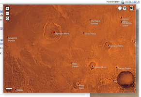 Mars WikiMiniAtlaksessa
 -
 Kuu WikiMiniAtlaksessa
 -
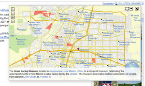 Article summaries (hold CTRL and hover a link)
 -
 3D overview globe in the bottom right corner (showing a WIWOSM overlay on both map and globe!)
 -
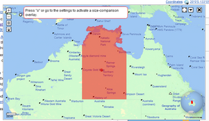
 Dragging around Texas for size comparison
 -
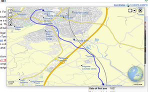 OpenStreetMap data, KML overlay (blue line), and additional article coordinates (blue dots). Febrauar 2012
 -
 Uusi yksityiskohtainen peruskartta
 -
 WikiMiniAtlas toiminnassa
 -
 Gizan pyramidit satelliittikuvassa
 -
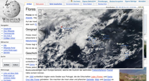 Nykyinen sää Azoreilla
 -
 Kesäkuu 2007


