
File:Abstetten - Ortsansicht.JPG
Size of this preview: 800 × 426 pixels. Other resolutions: 320 × 170 pixels | 640 × 341 pixels | 1,024 × 546 pixels | 1,280 × 682 pixels | 2,560 × 1,364 pixels | 5,010 × 2,669 pixels.
Original file (5,010 × 2,669 pixels, file size: 9.01 MB, MIME type: image/jpeg)
Summary
| Description |
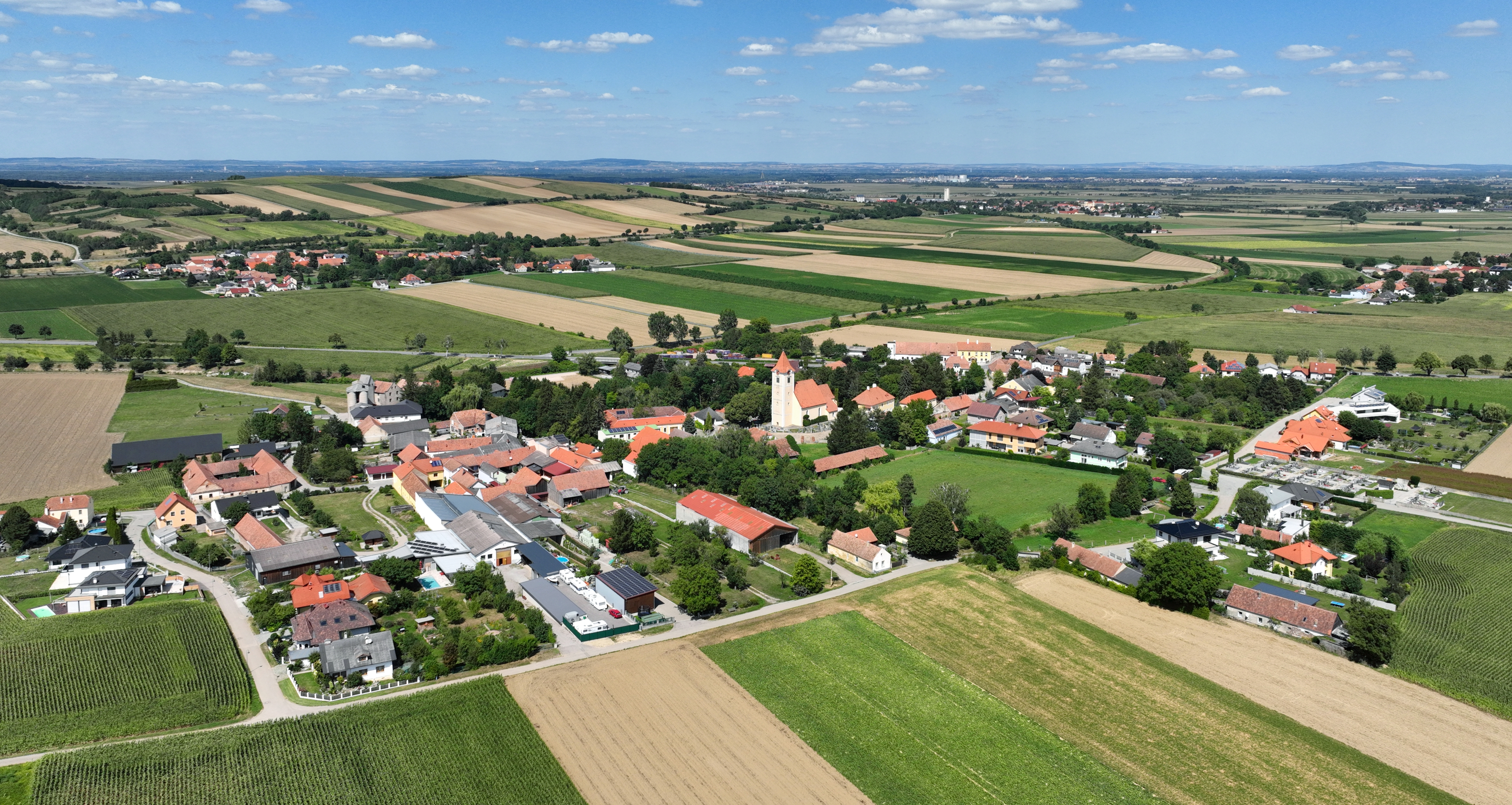
Deutsch: Südsüdwestansicht von Abstetten, ein Dorf in der niederösterreichischen Marktgemeinde Sieghartskirchen. Abstetten war eine eigenständige Gemeinde und wurde ab 1. Jän. 1972 mit den Gemeinden Kogl, Ollern, Rappoltenkirchen, Ried am Riederberg und Röhrenbach in die Gemeinde Sieghartskirchen eingegliedert.
English: South-southwest view of Abstetten in Lower Austria. |
| Date | |
| Source | Own work |
| Author | C.Stadler/Bwag |
| Permission (Reusing this file) |
Deutsch: Hallo, du darfst mein Foto kostenlos nutzen, aber nenne mich bitte als Fotograf, beispielsweise „Foto: C.Stadler/Bwag“ oder © C.Stadler/Bwag; CC-BY-SA-4.0. Auf mehr Angaben bestehe ich nicht - im Gegensatz zu manch anderen, die die Vorgaben der unten angeführten Lizenzierung auf Punkt und Beistrich einfordern. English: Feel free to use my photos, but please mention me as the author like © C.Stadler/Bwag or © C.Stadler/Bwag; CC-BY-SA-4.0 (that's good enough) and if you want send me a message: bwag@gmx.net. |
| Object location | | View this and other nearby images on: OpenStreetMap |
|---|
| Camera location | | View this and other nearby images on: OpenStreetMap |
|---|
Licensing
I, the copyright holder of this work, hereby publish it under the following license:
This file is licensed under the Creative Commons Attribution-Share Alike 4.0 International license.
- You are free:
- to share – to copy, distribute and transmit the work
- to remix – to adapt the work
- Under the following conditions:
- attribution – You must give appropriate credit, provide a link to the license, and indicate if changes were made. You may do so in any reasonable manner, but not in any way that suggests the licensor endorses you or your use.
- share alike – If you remix, transform, or build upon the material, you must distribute your contributions under the same or compatible license as the original.
| Annotations | This image is annotated: View the annotations at Commons |

File history
Click on a date/time to view the file as it appeared at that time.
| Date/Time | Thumbnail | Dimensions | User | Comment | |
|---|---|---|---|---|---|
| current | 19:06, 12 August 2022 | | 5,010 × 2,669 (9.01 MB) | Bwag | == {{int:filedesc}} == {{Information |Description= {{de|1= Südsüdwestansicht von Abstetten, ein Dorf in der niederösterreichischen Marktgemeinde Sieghartskirchen. Abstetten war eine eigenständige Gemeinde und wurde ab 1. Jän. 1972 mit den Gemeinden Kogl, Ollern, Rappoltenkirchen, Ried am Riederberg und Röhrenbach in die Gemeinde Sieghartskirchen eingegliedert.}} {{en|1= South-southwest view of Abstetten in Lower Austria.}} |Source= {{own}} |Date= 2022-08-09 |Author= Bwag |Perm... |
File usage
There are no pages that use this file.
Global file usage
The following other wikis use this file:
- Usage on de.wikipedia.org
- Usage on en.wikipedia.org
- Usage on www.wikidata.org