
File:Backenswarft, Hallig Hooge, Germany.jpg
Size of this preview: 800 × 425 pixels. Other resolutions: 320 × 170 pixels | 640 × 340 pixels | 1,024 × 544 pixels | 1,280 × 680 pixels | 2,738 × 1,455 pixels.
Original file (2,738 × 1,455 pixels, file size: 3.22 MB, MIME type: image/jpeg)
Summary
| Description |
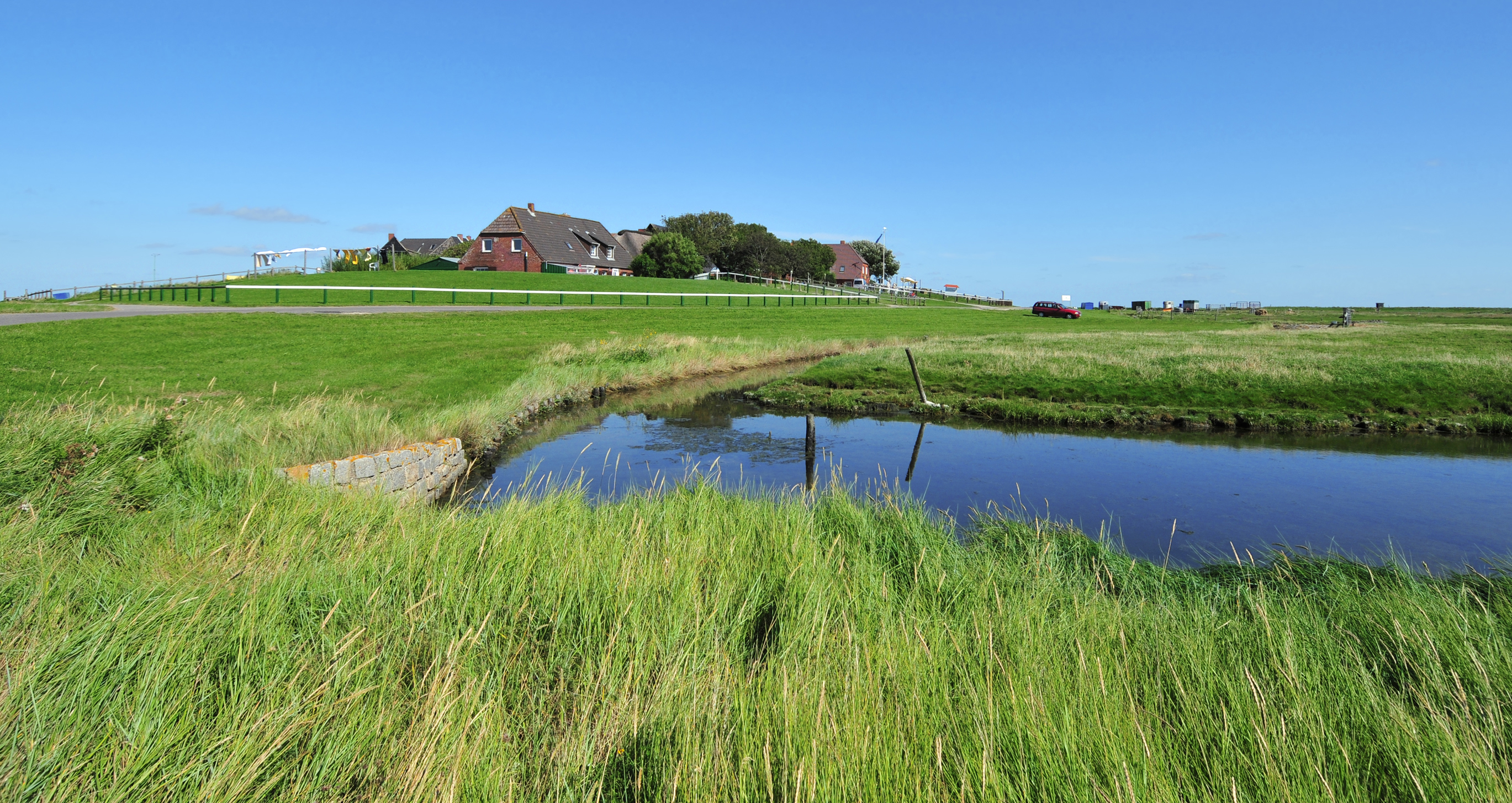
Deutsch: Blick auf die Backenswarft. Sie steht auf der Hallig Hooge. Die Hallig Hooge ist die zweitgrößte der zehn Halligen im Schleswig-Holsteinischen Wattenmeer. Hallig Hooge ist von einem rund 1,20 Meter hohen Steindeich umgeben und ist dadurch bei leichten Sturmfluten vor Landunter geschützt. Dennoch wird die Hallig Hooge zwei bis fünf Mal im Jahr vollständig überflutet. Die Wohnhäuser stehen auf hohen Warften, damit sie den Sturmfluten widerstehen können. Die Hallig Hooge besitzt zwölf Warften. Die Backenswarft ist die zweitgrößte Warft mit einem Dutzend Gebäuden, die ringförmig den Fething mit Regenwasser umschließen und vor Salzwasser schützen.
English: View to the Backenswarft on Hallig Hooge. The Hallig Hooge is the second largest of the ten islets in the Schleswig-Holstein Wadden Sea. Hallig Hooge is surrounded by an approximately 1.20 meters high stone dyke and is thus protected from light storm surges. Nevertheless Hallig Hooge is flooded completely two to five times a year. The Houses are built on high mounds. Therefore they can withstand the storm surges. The Hallig Hooge has twelve mounds. The Backenswarft is the second largest mound with a dozen buildings. The buildings surround the pond with rainwater. |
| Date | Taken on 27 August 2012 |
| Source | Own work |
| Author | Michael Gäbler |
| Camera location | | View this and other nearby images on: OpenStreetMap |
|---|
Licensing
Michael Gäbler, the copyright holder of this work, hereby publishes it under the following license:
This file is licensed under the Creative Commons Attribution 3.0 Unported license.
Attribution: Michael Gäbler
- You are free:
- to share – to copy, distribute and transmit the work
- to remix – to adapt the work
- Under the following conditions:
- attribution – You must give appropriate credit, provide a link to the license, and indicate if changes were made. You may do so in any reasonable manner, but not in any way that suggests the licensor endorses you or your use.
Assessment
|
File history
Click on a date/time to view the file as it appeared at that time.
| Date/Time | Thumbnail | Dimensions | User | Comment | |
|---|---|---|---|---|---|
| current | 19:55, 23 September 2012 | | 2,738 × 1,455 (3.22 MB) | Michael Gäbler | {{Information |Description= {{de|1= Blick auf die Backenswarft. Sie steht auf der Hallig Hooge. Die Hallig Hooge ist die zweitgrößte der zehn Halligen in dem [[:de:Nationalpark Schleswig-Holstei... |
File usage
There are no pages that use this file.
Global file usage
The following other wikis use this file:
- Usage on ace.wikipedia.org
- Usage on ca.wikipedia.org
- Usage on da.wikipedia.org
- Usage on de.wikipedia.org
- Usage on en.wikipedia.org
- Usage on eo.wikipedia.org
- Usage on ka.wikipedia.org
- Usage on mk.wikipedia.org
- Usage on nl.wikipedia.org
- Usage on pt.wikipedia.org
- Usage on ro.wikipedia.org
- Usage on ru.wikipedia.org
- Usage on sv.wikipedia.org
- Usage on war.wikipedia.org