
File:Mapa de Venezuela, N. Granada y Quito, 1819 y 1820.jpg
Original file (2,412 × 1,727 pixels, file size: 1.33 MB, MIME type: image/jpeg)
Summary
| Description |
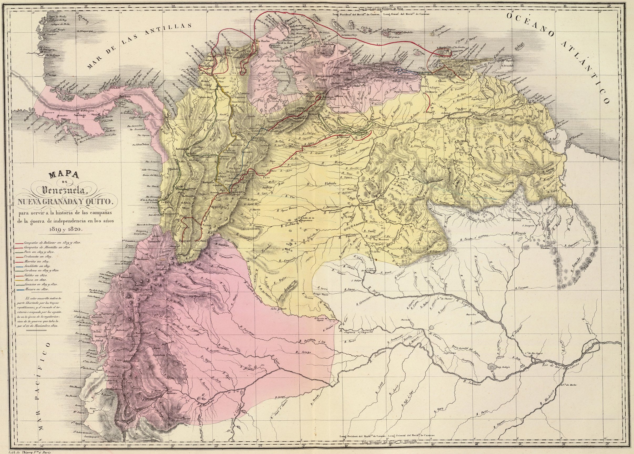
Español: Mapa de Venezuela, Nueva Granada y Quito, que muestras las campañas de la guerra de independencia entre 1819 y 1820. Tomado del "Atlas físico y político de la República de Venezuela", 1840. |
||||||||||||||||||||
| Date | |||||||||||||||||||||
| Source | Historical Maps by Agustín Codazzi, from David Rumsey Website | ||||||||||||||||||||
| Author |
|
||||||||||||||||||||

Licensing
|
This work is in the public domain in its country of origin and other countries and areas where the copyright term is the author's life plus 70 years or fewer.
| |
| This file has been identified as being free of known restrictions under copyright law, including all related and neighboring rights. | |
File history
Click on a date/time to view the file as it appeared at that time.
| Date/Time | Thumbnail | Dimensions | User | Comment | |
|---|---|---|---|---|---|
| current | 23:52, 20 October 2008 | | 2,412 × 1,727 (1.33 MB) | Milenioscuro | {{Information |Description= |Source= |Date= |Author= |Permission= |other_versions= }} |
| 21:29, 3 January 2008 |  | 1,239 × 893 (273 KB) | Milenioscuro | {{Information |Description=Venezuela, Nueva Granda y Quito, campañas de 1819 y 1820 |Source=http://www.davidrumsey.com |Date=1840 |Author=Agustín Codazzi |Permission= |other_versions= }} Category:Old maps of Colombia [[Category:Old maps of Venezuela |
File usage
There are no pages that use this file.
Global file usage
The following other wikis use this file:
- Usage on es.wikipedia.org
- Usage on fr.wikipedia.org
- Usage on no.wikipedia.org