
File:Argentina Santa Fe location map.svg

Size of this PNG preview of this SVG file: 360 × 600 pixels. Other resolutions: 144 × 240 pixels | 288 × 480 pixels | 461 × 768 pixels | 614 × 1,024 pixels | 1,229 × 2,048 pixels | 720 × 1,200 pixels.
Original file (SVG file, nominally 720 × 1,200 pixels, file size: 311 KB)
Summary
| Description |
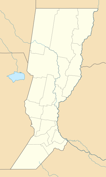
Deutsch: Positionskarte von Santa Fe (Argentinien) English: Location map of Santa Fe province (Argentina) Español: Mapa de localización de la Provincia de Santa Fe.
Equirectangular projection, N/S stretching 115 %. Geographic limits of the map:
|
| Date | (UTC) |
| Source |
This file was derived from: |
| Author |
|
| Other versions |
|

Licensing
This file is licensed under the Creative Commons Attribution-Share Alike 3.0 Unported license.
- You are free:
- to share – to copy, distribute and transmit the work
- to remix – to adapt the work
- Under the following conditions:
- attribution – You must give appropriate credit, provide a link to the license, and indicate if changes were made. You may do so in any reasonable manner, but not in any way that suggests the licensor endorses you or your use.
- share alike – If you remix, transform, or build upon the material, you must distribute your contributions under the same or compatible license as the original.
Original upload log
This image is a derivative work of the following images:
- File:Argentina_location_map.svg licensed with Cc-by-sa-3.0, GFDL
- File:Map_of_Santa_Fe_Province.svg licensed with Cc-by-sa-3.0,2.5,2.0,1.0, GFDL
Uploaded with derivativeFX
File history
Click on a date/time to view the file as it appeared at that time.
| Date/Time | Thumbnail | Dimensions | User | Comment | |
|---|---|---|---|---|---|
| current | 10:50, 10 September 2017 | | 720 × 1,200 (311 KB) | Milenioscuro | capas |
| 04:50, 27 August 2014 |  | 720 × 1,200 (484 KB) | קרלוס הגדול | Border between Buenos Aires to Cordoba | |
| 14:54, 11 July 2013 |  | 720 × 1,200 (484 KB) | Milenioscuro | == {{int:filedesc}} == {{Information |Description={{de|Positionskarte von Santa Fe (Argentinien)}}{{en|Location map of Santa Fe province (Argentina)}}{{es|1=Mapa de localización de la Provincia de Santa Fe.}} Equi... |
File usage
There are no pages that use this file.
Global file usage
The following other wikis use this file:
- Usage on de.wikipedia.org
- Pati (Talsperre)
- Estadio Monumental Rafaela
- Estadio 15 de Abril
- Wikipedia:Kartenwerkstatt/Positionskarten/Südamerika
- Estadio Marcelo Bielsa
- Estadio Gigante de Arroyito
- Estadio Brigadier General Estanislao López
- Benutzer:Kaisehr74/In Arbeit 8
- Puente Colgante de Santa Fe
- Vorlage:Positionskarte Argentinien Santa Fe
- Flughafen Reconquista
- Usage on en.wikipedia.org
- Rosario
- Santa Fe, Argentina
- Roldán, Santa Fe
- Rafaela
- Aarón Castellanos, Santa Fe
- Castellanos, Santa Fe
- Ramona, Santa Fe
- Llambi Campbell
- Module:Location map/data/Argentina Santa Fe Province
- Module:Location map/data/Argentina Santa Fe Province/doc
- Humberto Primo
- San Antonio, Santa Fe
- San Antonio-Castellanos
- Grutly
- Usage on eo.wikipedia.org
- Usage on es.wikipedia.org
View more global usage of this file.