
File:Elvas e muralhas.jpg

Size of this preview: 800 × 600 pixels. Other resolutions: 320 × 240 pixels | 640 × 480 pixels | 1,024 × 768 pixels | 1,280 × 960 pixels | 1,600 × 1,200 pixels.
Original file (1,600 × 1,200 pixels, file size: 586 KB, MIME type: image/jpeg)
Summary
| This file was uploaded for Wiki Loves Monuments in Portugal with the unique identifier 70353.
|
| Description |
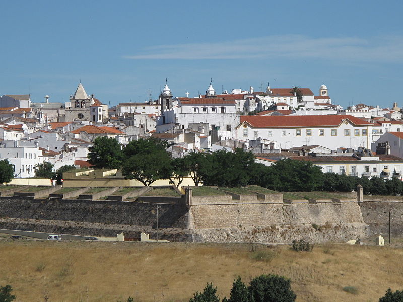
Deutsch: Historisches Zentrum von Elvas mit Bollwerk im Vordergrund |
| Date | |
| Source | Own work |
| Author | Dafema |
| Object location | | View this and other nearby images on: OpenStreetMap |
|---|
Licensing
I, the copyright holder of this work, hereby publish it under the following license:
This file is licensed under the Creative Commons Attribution-Share Alike 3.0 Unported license.
- You are free:
- to share – to copy, distribute and transmit the work
- to remix – to adapt the work
- Under the following conditions:
- attribution – You must give appropriate credit, provide a link to the license, and indicate if changes were made. You may do so in any reasonable manner, but not in any way that suggests the licensor endorses you or your use.
- share alike – If you remix, transform, or build upon the material, you must distribute your contributions under the same or compatible license as the original.
|
This monument is classified as
Monumento Nacional .It is indexed in the IGESPAR database ( Instituto de Gestão do Património Arquitectónico e Arqueológico ), under the reference 70353.
|
| This building is classified as Monumento Nacional. It is indexed in the SIPA database (Sistema de Informação para o Património Arquitetónico) under the reference 3245. |

|
This image was uploaded as part of Wiki Loves Monuments 2011.
|
 |
File history
Click on a date/time to view the file as it appeared at that time.
| Date/Time | Thumbnail | Dimensions | User | Comment | |
|---|---|---|---|---|---|
| current | 17:27, 24 September 2011 | | 1,600 × 1,200 (586 KB) | Dafema |
File usage
The following page uses this file:
Global file usage
The following other wikis use this file:
- Usage on arz.wikipedia.org
- Usage on be.wikipedia.org
- Usage on bg.wikipedia.org
- Usage on ca.wikipedia.org
- Usage on de.wikipedia.org
- Usage on de.wikivoyage.org
- Usage on en.wikipedia.org
- Usage on es.wikipedia.org
- Usage on eu.wikipedia.org
- Usage on fa.wikipedia.org
- Usage on fr.wikipedia.org
- Usage on gl.wikipedia.org
- Usage on he.wikipedia.org
- Usage on hi.wikipedia.org
- Usage on hu.wikipedia.org
- Usage on hy.wikipedia.org
- Usage on it.wikipedia.org
- Usage on ja.wikipedia.org
- Usage on kk.wikipedia.org
- Usage on ko.wikipedia.org
- Usage on ln.wikipedia.org
- Usage on ml.wikipedia.org
- Usage on mt.wikipedia.org
- Usage on nl.wikipedia.org
- Usage on pt.wikipedia.org
- Elvas
- Lista do Património Mundial em Portugal
- Forte de Nossa Senhora da Graça
- Forte de Santa Luzia
- Guerra das Laranjas
- Aqueduto da Amoreira
- Muralhas de Elvas
- Cidade-quartel fronteiriça de Elvas e as suas fortificações
- Usuário:DarwIn/MNs
- Wikipédia:Wiki Loves Monuments 2019/Portugal/Lista/Portalegre
- Património Mundial da UNESCO em Portugal
View more global usage of this file.