
File:La Cienega map.jpg

Size of this preview: 375 × 600 pixels. Other resolutions: 150 × 240 pixels | 300 × 480 pixels | 1,000 × 1,600 pixels.
Original file (1,000 × 1,600 pixels, file size: 818 KB, MIME type: image/jpeg)
| This work has been released into the public domain by its author, SPUI. This applies worldwide. In some countries this may not be legally possible; if so: |
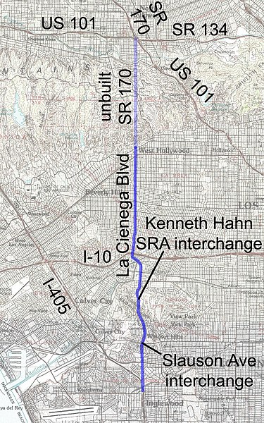
La Cienega Blvd (once planned as State Route 170) in the Los Angeles, California area. Drawn on a public domain USGS topo map.
File history
Click on a date/time to view the file as it appeared at that time.
| Date/Time | Thumbnail | Dimensions | User | Comment | |
|---|---|---|---|---|---|
| current | 21:46, 15 April 2005 | | 1,000 × 1,600 (818 KB) | SPUI~commonswiki | {{spuimap}} La Cienega Blvd (once planned as SR 170) in the Los Angeles area. category:Los Angeles, Californiacategory:California State Highway 170category:road maps |
File usage
There are no pages that use this file.
Global file usage
The following other wikis use this file:
- Usage on en.wikipedia.org
- Usage on fr.wikipedia.org
- Usage on pl.wikipedia.org
- Usage on www.wikidata.org