
File:Nabbia and South Africa maps.jpg

Size of this preview: 800 × 508 pixels. Other resolutions: 320 × 203 pixels | 640 × 406 pixels | 1,024 × 650 pixels | 1,280 × 813 pixels | 2,036 × 1,293 pixels.
Original file (2,036 × 1,293 pixels, file size: 670 KB, MIME type: image/jpeg)
Summary
| Description |
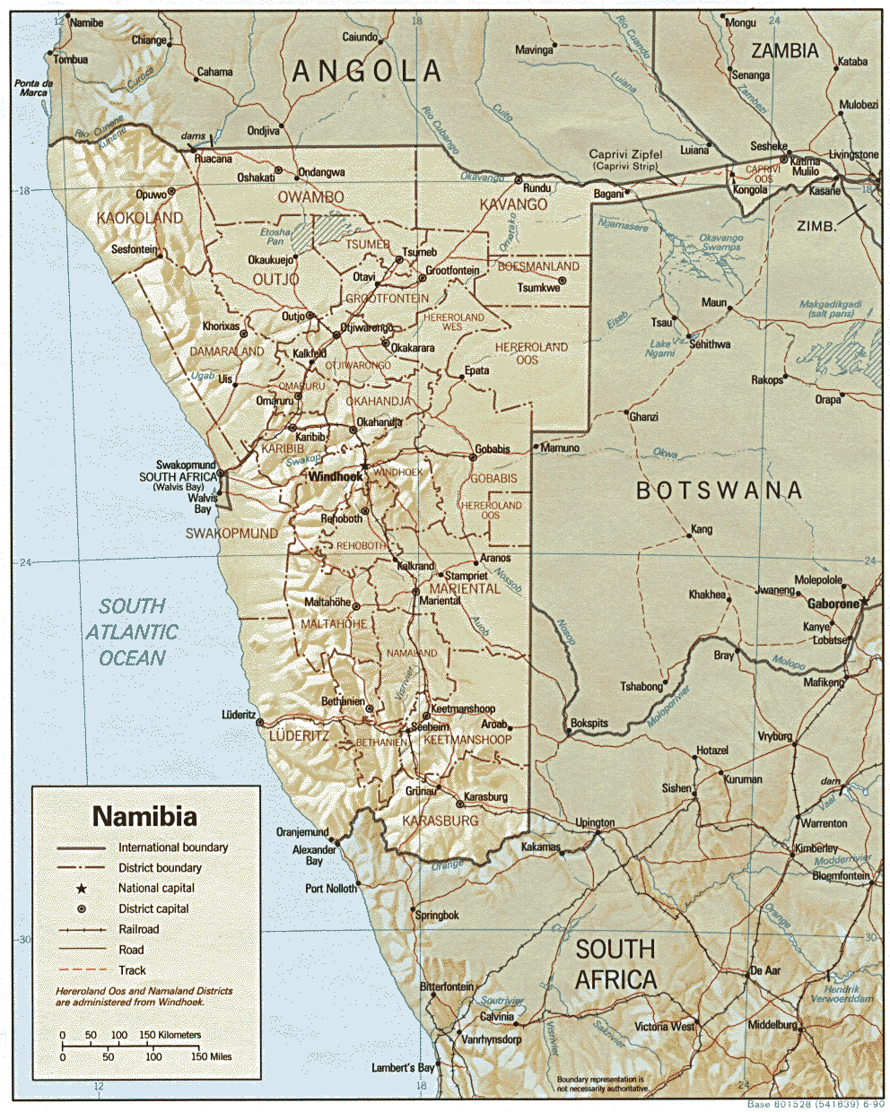
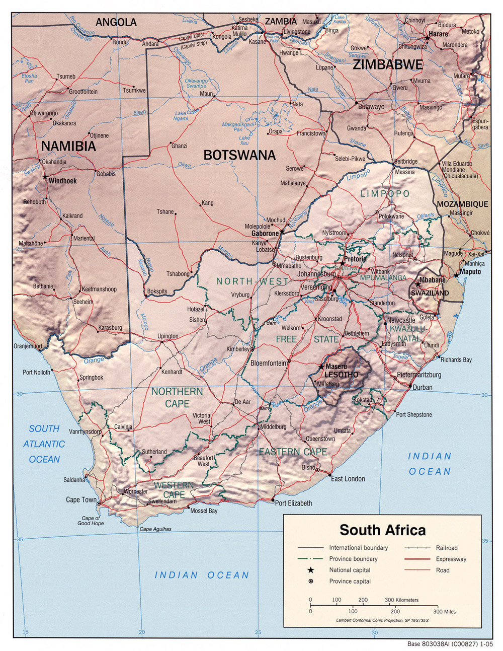
English: Nabbia and South Africa maps |
| Date | and 2005 |
| Source |
Composite map made from individual maps: |
| Author | U.S. Central Intelligence Agency |
Licensing
This work is in the public domain in the United States because it is a work prepared by an officer or employee of the United States Government as part of that person’s official duties under the terms of Title 17, Chapter 1, Section 105 of the US Code.
Note: This only applies to original works of the Federal Government and not to the work of any individual U.S. state, territory, commonwealth, county, municipality, or any other subdivision. This template also does not apply to postage stamp designs published by the United States Postal Service since 1978. (See § 313.6(C)(1) of Compendium of U.S. Copyright Office Practices). It also does not apply to certain US coins; see The US Mint Terms of Use.
|
 | |
| This file has been identified as being free of known restrictions under copyright law, including all related and neighboring rights. | ||
File history
Click on a date/time to view the file as it appeared at that time.
| Date/Time | Thumbnail | Dimensions | User | Comment | |
|---|---|---|---|---|---|
| current | 21:18, 26 March 2024 | | 2,036 × 1,293 (670 KB) | Gwillhickers | Uploaded a work by U.S. Central Intelligence Agency from Composite map made from individual maps: https://maps.lib.utexas.edu/maps/africa/namibia.gif -- Nambia https://maps.lib.utexas.edu/maps/africa/south_africa_rel_2005.jpg -- South Africa with UploadWizard |
File usage
There are no pages that use this file.
Global file usage
The following other wikis use this file:
- Usage on en.wikipedia.org