
File:Ontcoc.png
No higher resolution available.
Ontcoc.png (378 × 379 pixels, file size: 9 KB, MIME type: image/png)
Summary
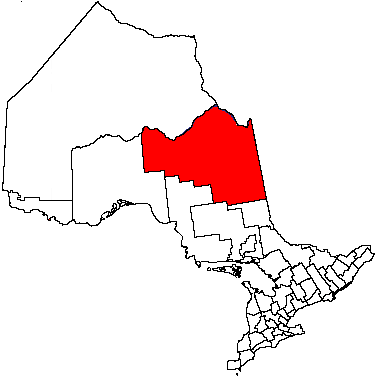
| Description | Cochrane District, Ontario |
| Date | 17 June 2004 (original upload date) |
| Source | Transferred from en.wikipedia to Commons. |
| Author | The original uploader was Timc at English Wikipedia. |
Licensing

|
Permission is granted to copy, distribute and/or modify this document under the terms of the GNU Free Documentation License, Version 1.2 or any later version published by the Free Software Foundation; with no Invariant Sections, no Front-Cover Texts, and no Back-Cover Texts. A copy of the license is included in the section entitled GNU Free Documentation License. |
| This file is licensed under the Creative Commons Attribution-Share Alike 3.0 Unported license. | ||
| ||
| This licensing tag was added to this file as part of the GFDL licensing update. |
Original upload log
The original description page was here. All following user names refer to en.wikipedia.
- 2004-06-17 02:16 Timc 378×379×8 (9676 bytes) Cochrane District, Ontario
File history
Click on a date/time to view the file as it appeared at that time.
| Date/Time | Thumbnail | Dimensions | User | Comment | |
|---|---|---|---|---|---|
| current | 20:13, 26 November 2006 | | 378 × 379 (9 KB) | Hopperseven | {{Information |Description=Cochrane District, Ontario |Source=Originally from [http://en.wikipedia.org en.wikipedia]; description page is/was [http://en.wikipedia.org/w/index.php?title=Image%3AOntcoc.PNG here]. |Date=2004-06-17 (original upload date) |Aut |
File usage
There are no pages that use this file.
Global file usage
The following other wikis use this file:
- Usage on en.wikipedia.org
- Timmins
- Kapuskasing
- Moosonee
- Abitibi Canyon
- Unorganized North Cochrane District
- Cochrane, Ontario
- Black River-Matheson
- Cochrane District
- Iroquois Falls
- Hearst, Ontario
- Moose Factory
- Fort Albany First Nation
- Kashechewan First Nation
- Smooth Rock Falls
- Moonbeam, Ontario
- Grant, Ontario
- Mattice-Val Côté
- Opasatika
- Fauquier-Strickland
- Val Rita-Harty
- Moose Factory 68
- Marten Falls First Nation
- Wahgoshig First Nation
- Lac-Sainte-Thérèse
- Val Gagné, Ontario
- Constance Lake First Nation
- Jogues, Ontario
- Coppell, Ontario
- Mead, Ontario
- Calstock, Ontario
- Hallébourg
- Kitigan
- Driftwood, Ontario
- Gardiner, Ontario
- Frederick, Ontario
- Hunta
- Norembega
- Brower, Ontario
- Departure Lake, Ontario
- Unorganized South East Cochrane District
- Unorganized South West Cochrane District
- Flying Post First Nation
- Low Bush River
- Moose Cree First Nation
- Pagwa River
- Template:Cochrane District
- Smoky Falls
- Reesor, Ontario
- Ghost River, Cochrane District
- Taykwa Tagamou Nation
View more global usage of this file.