
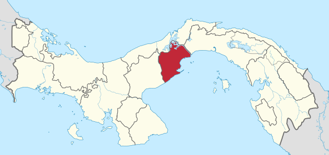
File:Panama Oeste in Panama.svg

Size of this PNG preview of this SVG file: 800 × 379 pixels. Other resolutions: 320 × 152 pixels | 640 × 303 pixels | 1,024 × 485 pixels | 1,280 × 606 pixels | 2,560 × 1,212 pixels | 1,117 × 529 pixels.
Original file (SVG file, nominally 1,117 × 529 pixels, file size: 424 KB)
Summary
.svg)
.svg)
.svg)
.svg)
.svg)
.svg)
.svg)

-en.svg)

.svg)
.svg)
.svg)

_(US48).svg)
_(small_islands_magnified)_(-mini_map_-rivers).svg)
.svg)
_(extra_close)_(US48).svg)
.svg)
_(zoom).svg)

.svg)


_(UNMIK).svg)
.svg)
_(disputed_hatched).svg)
_(claimed_and_disputed_hatched).svg)
.svg)
.svg)
_(%2Ball_claims_hatched).svg)

.svg)
_(shade).svg)
_(shade)_(special_marker).svg)
_(-mini_map).svg)
_(-mini_map).svg)
_(-mini_map).svg)


.svg)

.svg)
Licensing
I, the copyright holder of this work, hereby publish it under the following licenses:

|
Permission is granted to copy, distribute and/or modify this document under the terms of the GNU Free Documentation License, Version 1.2 or any later version published by the Free Software Foundation; with no Invariant Sections, no Front-Cover Texts, and no Back-Cover Texts. A copy of the license is included in the section entitled GNU Free Documentation License. |
This file is licensed under the Creative Commons Attribution-Share Alike 3.0 Unported license.
- You are free:
- to share – to copy, distribute and transmit the work
- to remix – to adapt the work
- Under the following conditions:
- attribution – You must give appropriate credit, provide a link to the license, and indicate if changes were made. You may do so in any reasonable manner, but not in any way that suggests the licensor endorses you or your use.
- share alike – If you remix, transform, or build upon the material, you must distribute your contributions under the same or compatible license as the original.
You may select the license of your choice.
File history
Click on a date/time to view the file as it appeared at that time.
| Date/Time | Thumbnail | Dimensions | User | Comment | |
|---|---|---|---|---|---|
| current | 17:42, 28 December 2020 | | 1,117 × 529 (424 KB) | Milenioscuro | new comarca: Naso Tjerdi |
| 14:12, 13 April 2017 |  | 1,246 × 628 (343 KB) | Man77 | == {{int:filedesc}} == {{Information |Description={{de|Lage der Provinz Panamá Oeste in Panama.}} {{en|Location of province Panamá Oeste in Panama.}} |Source={{own}}{{AttribSVG|Panama location map.svg|Alexrk2}}{{AttribSV... |
File usage
There are no pages that use this file.
Global file usage
The following other wikis use this file:
- Usage on ar.wikipedia.org
- Usage on bg.wikipedia.org
- Usage on ca.wikipedia.org
- Usage on cs.wikipedia.org
- Usage on de.wikipedia.org
- Usage on en.wikipedia.org
- La Ermita
- Arraiján
- Capira
- Cermeño
- Chame, Panama
- Lídice
- Nueva Gorgona
- Nuevo Arraiján
- Nuevo Emperador
- Puerto Caimito
- Sajalices
- San Vicente de Bique
- Villa Carmen, Panama
- Villa Rosario
- Santa Clara, Panamá Oeste
- Arraiján District
- Capira District
- Chame District
- La Chorrera District
- San Carlos District, Panama
- Sorá
- Barrio Balboa, Panama
- Vista Alegre, Panama
- Template:Panamá Oeste Province
- Panamá Oeste Province
- Burunga
- Cerro Silvestre
- Juan Demóstenes Arosemena, Panama
- Veracruz, Panama
- Caimito, Panama
- Campana, Panama
- Cirí de Los Sotos
- Cirí Grande
- El Cacao, Panamá Oeste
- La Trinidad, Panama
- Las Ollas Arriba
- Santa Rosa, Panamá Oeste
- Bejuco, Panama
- Buenos Aires, Chame
- Cabuya, Panamá Oeste
- Chicá
- El Líbano
- Las Lajas, Panamá Oeste
- Punta Chame
View more global usage of this file.