
File:Sumadija region.png

Size of this preview: 377 × 598 pixels. Other resolutions: 151 × 240 pixels | 302 × 480 pixels | 664 × 1,054 pixels.
Original file (664 × 1,054 pixels, file size: 49 KB, MIME type: image/png)
Summary
| Description |
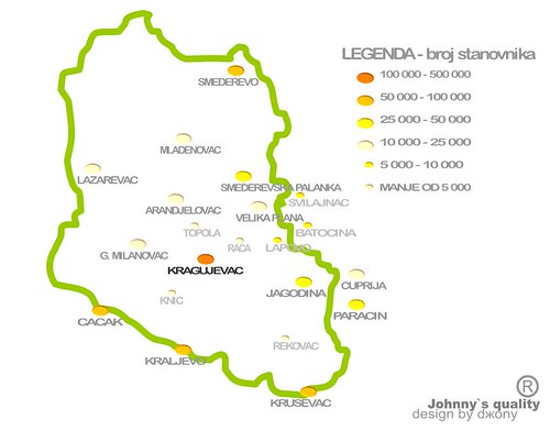
English: Map of Šumadija region in Serbia. Serbian: Мапа Шумадије у Србији. |
||
| Date | |||
| Source | Own work | ||
| Author | PANONIAN | ||
| Permission (Reusing this file) |
|
References
- Miodrag Milošević, Geografija za 8. razred osnovne škole, Beograd, 1994.
- Milovan Radovanović, Kosovo i Metohija - antropogeografske, istorijskogeografske, demografske i geopolitičke osnove, Beograd, 2008.
- Dragan Rodić, Geografija za I ili III razred srednje škole, Beograd, 1995.
- http://www.serbiainyourhands.com/Maps/Sumadija.jpg
- http://farm2.static.flickr.com/1342/1316209008_09b707caa5.jpg
Licensing
| I, the copyright holder of this work, release this work into the public domain. This applies worldwide. In some countries this may not be legally possible; if so: I grant anyone the right to use this work for any purpose, without any conditions, unless such conditions are required by law. |
File history
Click on a date/time to view the file as it appeared at that time.
| Date/Time | Thumbnail | Dimensions | User | Comment | |
|---|---|---|---|---|---|
| current | 14:56, 5 October 2009 | | 664 × 1,054 (49 KB) | PANONIAN | |
| 23:11, 2 October 2009 |  | 664 × 1,054 (48 KB) | PANONIAN | {{Information |Description={{en|1=Map of Šumadija region in Serbia. }} |Source={{own}} |Author=PANONIAN |Date= |Permission={{PD-user|PANONIAN}} |other_versions= }} Category:Maps of geographical regions in Serbia [[Category:Šumadija |
File usage
There are no pages that use this file.
Global file usage
The following other wikis use this file:
- Usage on az.wikipedia.org
- Usage on ba.wikipedia.org
- Usage on be-tarask.wikipedia.org
- Usage on be.wikipedia.org
- Usage on bg.wikipedia.org
- Usage on bs.wikipedia.org
- Usage on cs.wikipedia.org
- Usage on fr.wikipedia.org
- Usage on hr.wikipedia.org
- Usage on hy.wikipedia.org
- Usage on id.wikipedia.org
- Usage on ru.wikipedia.org
- Usage on simple.wikipedia.org
- Usage on sv.wikipedia.org
- Usage on tr.wikipedia.org